As we gear up for the long-awaited Easter weekend, it seems Mother Nature has some surprises in store for us.
According to meteorologist Goldberg, we are in for a mix of spring rain, showers, and even snow.
Yes, you heard that right – snow in April!
Brace yourselves as Easter Sunday might bring along some thunderstorms and hail, reminiscent of last Sunday’s weather pattern.
The forecast indicates a high possibility of a repeat performance, keeping us on our toes as we approach the Easter Sunday festivities.
Goldberg confidently predicts a soggy Easter Sunday, with the current dry spell making way for wet conditions.
However, before we dive into the rainy weekend, let’s take a moment to appreciate the beautiful Wednesday ahead of us.
With temperatures soaring into the 60s, 70s, and even 80s in Palm Springs, it’s a sight to behold.
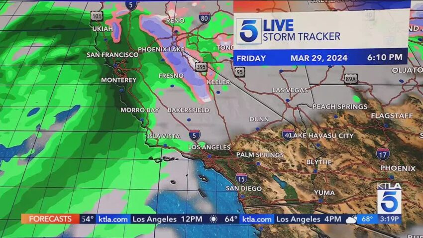
While the wet weather lingers up north, a storm brewing late Friday promises to bring a significant shift in our weather patterns.
A quick-moving shortwave is set to sweep through central California, steering clear of any rainfall but ushering in stronger winds and a denser marine layer for the desert communities.
Southern California might experience calm winds, except for areas like Victorville and Barstow, where gusty winds are expected, prompting a wind advisory until early Friday morning.
The looming low-pressure system, currently drenching the Pacific Northwest, is slowly inching its way towards us, promising rain and mountain snow by late Friday night.
As we transition into the weekend, the weather narrative unfolds with the weak system making a brief appearance on Thursday before intensifying on Friday, leading to a thicker marine layer.
By Saturday morning, the rain and mountain snow will descend upon us, persisting through Saturday afternoon and night.
A brief respite awaits the inland areas on Sunday morning before the wet weather returns for Easter Sunday afternoon and Monday morning, setting the tone for a damp start to the workweek.
Looking ahead to Monday afternoon, inland communities can expect wraparound moisture, followed by a return to dry conditions by Tuesday.
The gradual warming trend will kick in, offering some relief from the chilly temperatures experienced over the weekend.
Thursday afternoon’s forecast for woodland hills hints at partly cloudy skies, while Palmdale and Lancaster brace for windy conditions.
Downtown Hollywood and Long Beach airport will see temperatures in the upper sixties, with a similar pattern extending across the L.A. Basin.
With the anticipation of late showers and thunderstorms over the weekend, coupled with daytime highs in the mid to upper fifties, low sixties, it’s advisable to have your umbrellas at the ready and to dress warmly.
Minor flooding may pose a risk on streets and highways, urging caution during your travels.
Stay tuned for further updates as we draw closer to the Easter weekend, ensuring you are well-prepared for whatever weather whims come our way.
